The Work of Moving Ice
Over the last 2.6 million years (the Quaternary Period), Scandinavia cycled through more than twenty major glacial-interglacial oscillations. By examining fresh bedrock forefields around Jostedalsbreen and the drowned troughs of Sognefjorden, we can separate the two primary tools of moving ice—abrasion and plucking—and see how they carved the modern landscape.
Abrasion vs. Quarrying (Plucking)
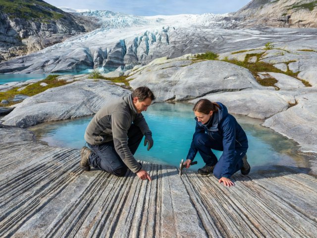
Clean ice by itself is softer than quartz or feldspar; it cannot scratch granite. The real cutting tool is the debris frozen into the lowest metre of the glacier sole. As hundreds of metres of overlying ice press downward, rock fragments are dragged across the bedrock floor.
Fine silt polishes the rock to a satin sheen that reflects sunlight like a mirror, while sand and cobbles gouge linear glacial striations (skuringsstriper). Wherever the ice rides over a bedrock bump, pressure increases on the upstream side (melting a thin film of water that travels to the low-pressure downstream cavity and refreezes). This freeze-thaw action pries loose entire joint-bounded blocks—a process called plucking or quarrying.
Place your palm flat on a glacially sculpted whaleback ridge (svaberg) in Nigardsbreen valley. Slide your hand in both directions along the scratches. The direction that feels smooth is the direction the ice moved; the direction that catches your fingertips on tiny micro-ledges points back toward the glacier source.
Why Sognefjorden Is Deeper Inside Than at the Coast
A river can only erode down to sea level. Yet Sognefjorden reaches an extraordinary water depth of 1,308 metres near Høyanger—more than a kilometre below current sea level—while near the open ocean at Solund, the fjord floor rises steeply to form a shallow bedrock threshold (fjordterskel) only 100 to 200 metres deep.
How did ice excavate a basin more than a kilometre below sea level? Thick confluent ice streams draining off the interior plateaus funnelled into narrow fault-guided valleys. Because ice was 2,000+ metres thick inland, its immense weight kept it grounded on the trough floor far below sea level, gouging deep into fractured bedrock. Near the outer coast, the ice thinned, spread out, and began to float, losing its downward erosive power and leaving the shallow coastal sill intact.
Norwegian Ice Caps (Breen) and Post-Glacial Rebound
Norway distinguishes between two main glacier geometries that produce dramatically different mountain skylines:
-
Plateau Ice Caps (Platåbreer — e.g., Jostedalsbreen, Folgefonna, Hardangerjøkulen)
Broad domes of ice resting on flat high-elevation peneplains, spilling radial outlet tongues (such as Briksdalsbreen and Bøyabreen) down into surrounding valleys. Note: Modern Norwegian glaciers are not unbroken remnants of the Last Glacial Maximum; they melted away completely during the warm Holocene Thermal Maximum (~8,000–5,000 years ago) and regrew when climates cooled roughly 4,000 years ago.
-
Cirque and Valley Glaciers (Botn- og Dalbreer — e.g., Hurrungane, Sunnmørsalpane)
Nestled in steep amphitheatres where headwall frost-shattering eats backward into peaks, sculpting razor-sharp ridges (egger) and pyramidal horns like Store Skagastølstind (2,405 m).
-
Isostatic Rebound & Raised Marine Terraces (Marin Grense)
Pressed down by 3 km of ice during the Weichselian glaciation, Norway’s crust has rebounded up to 220 metres in the Oslo and Trøndelag regions since deglaciation. In fjord valleys like Lærdal and Sunndal, flat gravel benches perched high up the valley sides mark where river deltas built out into the sea 9,500 years ago.