Life Above the Treeline
In Scandinavia’s mountains, ecology cannot be separated from geology. Once you climb above the shelter of the subalpine birch forest, every plant cushion and reindeer trail is governed by two physical variables: how quickly the underlying rock releases calcium nutrients, and how deeply winter snow protects the ground from desiccating frost.
Reading the Three Alpine Elevation Belts
Unlike the Alps of central Europe, where conifers form the upper timberline, Norway’s alpine treeline is formed by hardy mountain downy birch (Betula pubescens ssp. czerepanovii). In Jotunheimen (around 61.5°N), the treeline reaches roughly 1,100 to 1,200 metres; follow the mountain chain northward to 70°N in Finnmark, and the treeline descends to sea level.
Above the last twisted birches, field ecologists divide the mountain slopes into three distinct thermal zones that you can identify by the continuity of ground cover:
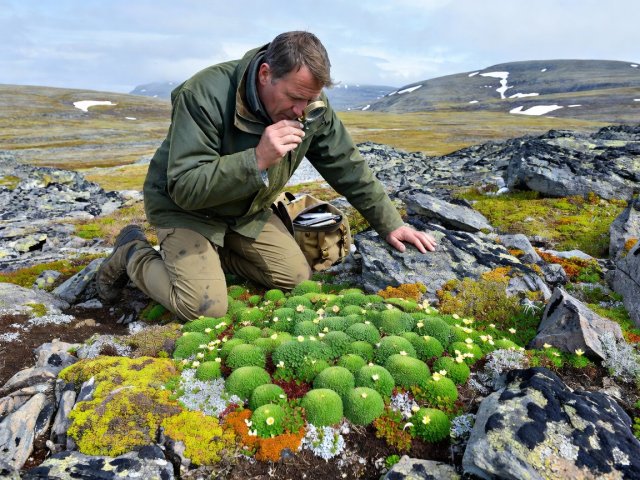
-
Low-Alpine Zone (Lavalpin sone — ~1,050 to 1,400 m in South Norway)
Continuous carpet of woody dwarf shrubs: dwarf birch (Betula nana), bilberry, crowberry, and grey willows. Soil profiles are well developed over glacial till.
-
Middle-Alpine Zone (Mellomalpin sone — ~1,400 to 1,750 m in South Norway)
Woody shrubs vanish except for prostrate dwarf willow (Salix herbacea). Tough graminoids—three-leaved rush (Juncus trifidus) and stiff sedge (Carex bigelowii)—form patchy turf separated by frost-heaved gravel.
-
High-Alpine Zone (Høyalpin sone — above ~1,750 m)
Blockfields (blokkhav) of frost-shattered boulders dominated by lichens and mosses. Only a handful of vascular plants survive, notably the glacier buttercup (Ranunculus glacialis), which has been recorded up to 2,370 metres on Galdhøpiggen.
Acidic Gneiss vs. Calcareous Phyllite — and the Ridge-to-Snowbed Gradient
Why is Rondane National Park famous for pale, austere expanses of yellow-white reindeer lichen (Cladonia stellaris), whereas neighbouring Dovrefjell is celebrated by botanists as a green oasis of rare orchids and arctic herbs? Look at the geological map.
Rondane is built of nutrient-poor, slow-weathering sparagmite (meta-arkose sandstone and quartzite) that produces acidic soil. Dovrefjell’s eastern peaks (such as Knutshøe) expose soft, calcareous Cambro-Silurian phyllites and greenstones that release calcium and magnesium as they weather, supporting lime-loving (calciphile) species like purple saxifrage (Saxifraga oppositifolia) and mountain avens (Dryas octopetala).
Even on uniform rock, micro-topography creates contrasting worlds within five metres:
Wind-Scoured Ridge (Rabbe): Blown free of snow all winter; plants face -25°C frost and wind abrasion. Look for trailing azalea (Kalmia procumbens) and hardy crustose lichens.
Protected Lee Slope (Leside): Insulated under 1–2 metres of snow from November to early June; richest flower meadows.
Late Snowbed (Snøleie): Hollows where snow melts only in late July, leaving a 5-week growing season dominated by dwarf willow and snowbed mosses.
Patterned Ground, Permafrost, and Lichenometry
Walk across a flat plateau at 1,500 metres in Jotunheimen or Dovrefjell and you will often stumble upon stone rings and polygons (strukturmark) that look so regular you might suspect hikers arranged them by hand. Fine wet silt expands more when freezing than coarse gravel. Over hundreds of autumn-spring freeze-thaw cycles, frost heave pushes cobbles outward into neat polygonal borders surrounding muddy centres.
Look also at the bright yellow-green disks of map lichen (Rhizocarpon geographicum) on siliceous boulders. Because this species grows at a slow, measurable radial rate (roughly 0.3 to 0.5 mm per year in high-alpine Norway), geologists measure the largest lichen thallus on a moraine ridge or rockfall lobe to estimate how many centuries the rock surface has been exposed to daylight—a technique known as lichenometry.